

Laura has become a very powerful hurricane this morning. The satellite presentation has continued to improve with the eye becoming better defined, and cloud tops colder than -70C in the surrounding ring of deep convection. Both NOAA and Air Force hurricane hunter aircraft have provided valuable data this morning.
The NOAA P-3 aircraft reported a peak flight-level wind of 125 kt at 8000 ft, and a peak SFMR wind of 104 kt, while the Air Force crew has observed peak 700-mb flight-level winds of 121 kt and peak SFMR winds of 104 kt. The lastest minimum pressure estimated from aircraft data is 956 mb, indicating a pressure drop of 27 mb over the past 12 hours. Based on the aircraft data, the initial wind speed was increased to 100 kt on the 1200 UTC intermediate advisory, and is now set at 110 kt based on the latest flight-level and SFMR winds.
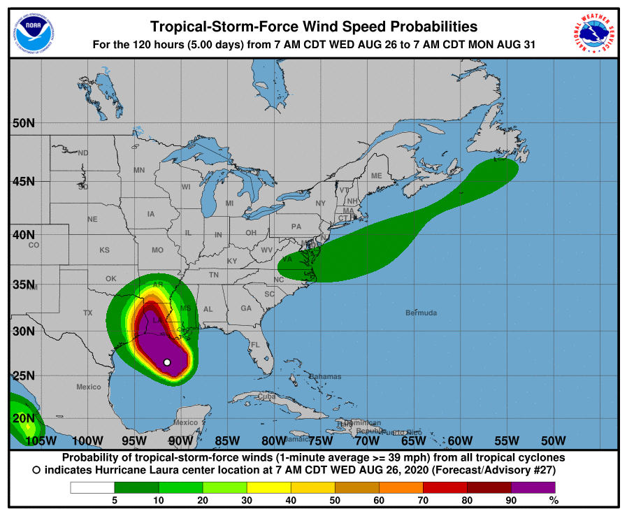
Laura is likely to continue strengthening today while it moves over warm waters of the northwestern Gulf of Mexico and the vertical wind shear remains low. Laura's intensity could level-off by this evening due to the possibility of an eyewall replacement cycle and the expected increase in shear around the time of landfall. Even if the rate of strengthening eases, Laura is expected to be an extremely powerful category 4 hurricane when it reaches the northwestern Gulf coast. After landfall, rapid weakening will occur, but Laura will bring a swath of damaging winds well inland over western Louisiana and eastern Texas.
The UKMET and ECMWF models suggest that there is some chance that Laura re-intensifies as a tropical cyclone off the mid-Atlantic coast, but given the uncertainties at that time range the forecast continues to show it as a post-tropical cyclone at days 4 and 5. Laura is moving northwestward at about 13 kt. A gradual turn toward the north-northwest and north are expected within the next 12-18 hours as the hurricane moves around the western portion of a mid- level ridge that extends from the western Atlantic into the southeastern United States. This motion will bring the center of Laura onshore in southwestern Louisiana or extreme eastern Texas tonight. By Thursday night, Laura is forecast to turn northeastward, and then east-northeastward on Friday as it becomes embedded in the mid-latitude westerlies. The dynamical track models are in good agreement, and little adjustment to the previous NHC forecast track was required.
Laura