

TUES. 10 PM OVERALL OUTLOOK:
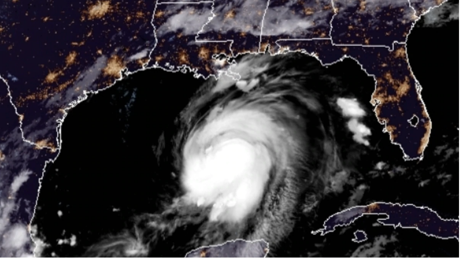
At 1000 PM CDT (0300 UTC), the center of Hurricane Laura was located near latitude 25.2 North, longitude 89.5 West. Laura is moving toward the west-northwest near 17 mph (28 km/h), and this general motion should continue overnight. A turn toward the northwest is forecast on Wednesday, and a northwestward to north-northwestward motion should continue through Wednesday night. On the forecast track, the center of Laura will move across the northwestern Gulf of Mexico on Wednesday. The hurricane should approach the Upper Texas and southwest Louisiana coasts on Wednesday evening and move inland near those areas Wednesday night or Thursday morning.
Maximum sustained winds have increased to near 90 mph (150 km/h) with higher gusts. Significant strengthening is forecast during the next 24 hours, and Laura is expected to be a major hurricane at landfall. Rapid weakening is expected after Laura makes landfall. Hurricane-force winds extend outward up to 45 miles (75 km) from the center and tropical-storm-force winds extend outward up to 175 miles (280 km). NOAA buoy 42001 in the central Gulf of Mexico recently reported a sustained wind of 45 mph (72 km/h) and a gust to 54 mph (86 km/h). The minimum central pressure estimated from Hurricane Hunter observations is 978 mb (28.88 inches).
TUES. 10 PM