

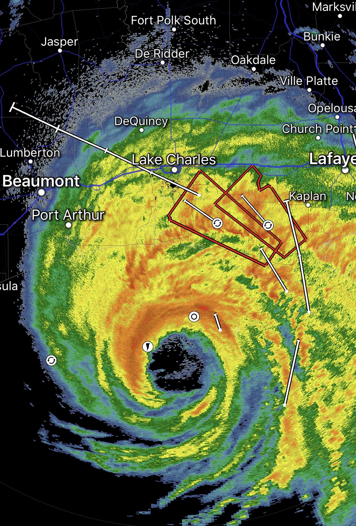
The 10 p.m. update from the National Hurricane Center: Maximum sustained winds are near 150 mph with higher gusts. No significant change in strength is likely before landfall, which is expected just east of the Texas/Louisiana state line in a few hours as a Category 4 storm.
1. Unsurvivable storm surge with large and destructive waves will cause catastrophic damage from Sea Rim State Park, Texas, to Intracoastal City, Louisiana, including Calcasieu and Sabine Lakes. This surge could penetrate up to 40 miles inland from the immediate coastline, and flood waters will not fully recede for several days after the storm.
2. Hurricane-force winds are expected tonight in portions of the hurricane warning area, with catastrophic wind damage expected where Laura's eyewall moves onshore. Hurricane-force winds and widespread damaging wind gusts will spread well inland into portions of extreme eastern Texas and western Louisiana early Thursday.
3. Widespread flash flooding along small streams, urban areas, and roadways is expected to begin overnight tonight into Thursday from far eastern Texas into Louisiana and Arkansas. This will also lead to minor to moderate freshwater river flooding. The heavy rainfall threat and flash and urban flooding potential will spread northeastward into the middle-Mississippi, lower Ohio, and Tennessee Valleys Friday night and Saturday.
Laura