

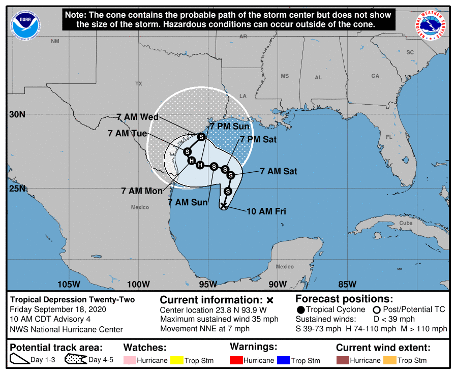
From the National Hurricane Center on Friday, Sept. 18, 10 a.m.
Satellite imagery indicates that Tropical Depression Twenty-Two is getting better organized with gradually increasing convective banding in the northeastern semicircle, which the depression is close to tropical-storm strength and would be named Tropical Storm Alpha.
The initial motion is a somewhat uncertain. For the next 24 hours or so, the cyclone should move north-northeastward as it is steered by a mid- to upper-level trough over Texas and northeastern Mexico. This trough is then expected to lift out to the northeast, with low- to mid-level ridging building to the north of the cyclone. This should cause a westward turn at a continued slow forward speed.
Near the end of the forecast period, a mid-latitude trough over the central United States should cause the ridge to weaken and steer the cyclone northward to northeastward near the Texas coast. While the guidance agrees with this general sense of the motion, there are a lot of differences in the models on the when's and where's of the various turns. Therefore, it is critical that users not focus on the exact forecast track, especially at days 4 and 5 when the average NHC forecast error is about 175 and 200 miles, respectively.
TD22